
We have several different interactive maps available to the public. Click on the thumbnail to use the associated viewer!
Allegany State Park Viewer
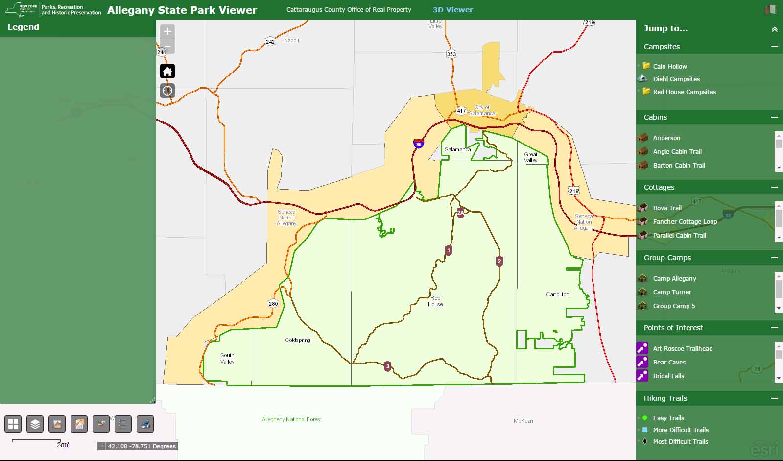
Created with the help of Allegany State Park staff, our Allegany State Park Viewer contains all of the campsites, cabin trails and cottages that are available for rent and are complete with street level photography for each site. Aerial and oblique photography of campsites and cabins can be viewed with the Pictometry widget to gain a better perspective on the site/area of interest. When a site of interest has been found, each cabin/campsite point contains a link to the ASP reservation page so the site can be reserved. Also present on the viewer are hiking trails complete with photos and other points of interest within the park.
Information on how to view and save this viewer on an Android device.
Information on how to view and save this viewer on an iPhone or iPad.
Cemetery Viewer
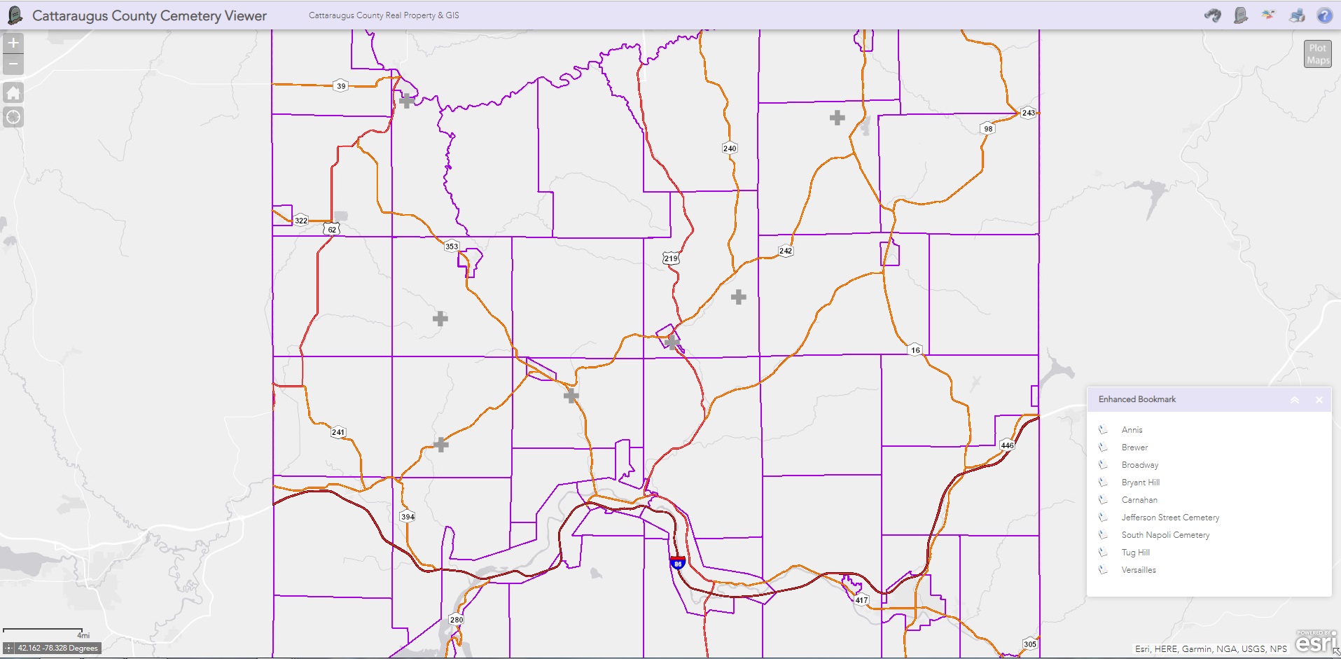
Our Cemetery Viewer contains information from several cemeteries within Cattaraugus County. Each headstone has been accurately placed on the map with the use of a high powered GPS unit, along with its given information if readable. Photos have been taken of each headstone and are displayed on the viewer as well. There is also a search widget on the viewer, where headstones can be searched by cemetery, occupant last name and death date.
Mobile Device Compatible Viewers
Outdoor Viewer
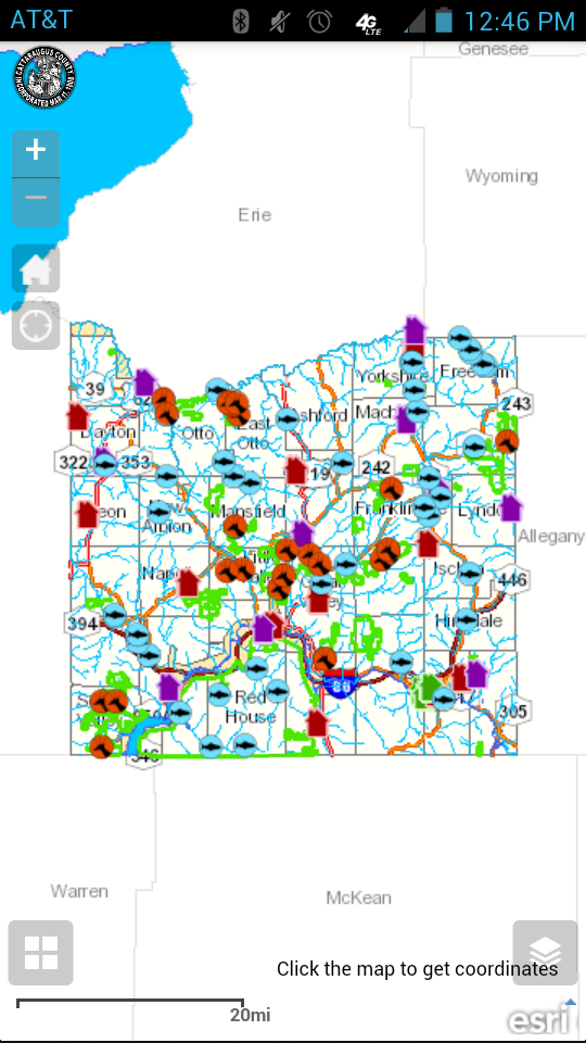
Our Outdoor Viewer contains the same parcel information that is available on our Parcel Viewer, along with information on state lands, state land parking areas public fishing access and areas of public fishing rights, and stores with hunting and fishing supplies. Environmental information such as contours, lake contours, and water bodies are also available. The application has the ability to make use of GPS capabilities within mobile devices, which will pinpoint your location on the map.
Information on how to view and save this viewer on an Android device.
Information on how to view and save this viewer on an iPhone or iPad.
Snowmobile Viewer
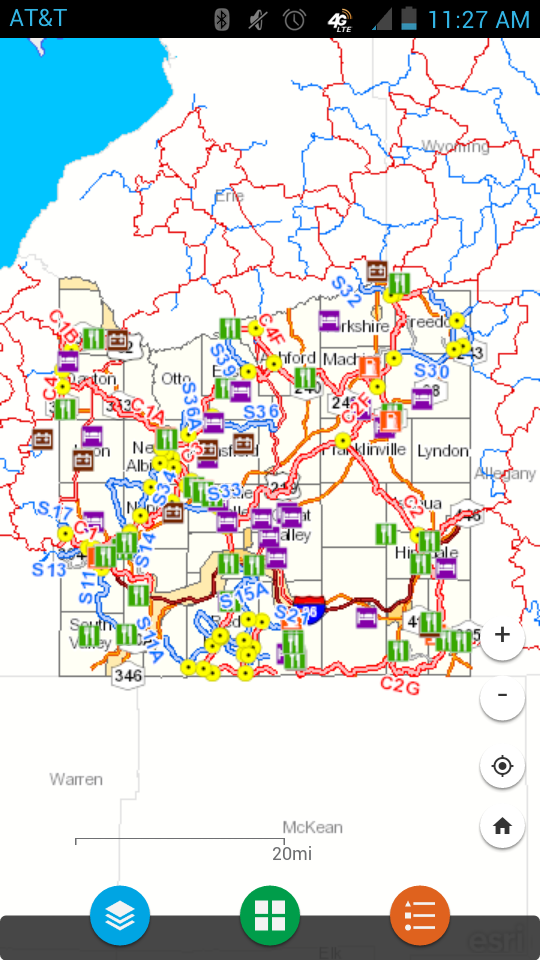
Our Snowmobile Viewer contains all of the funded and some of the unfunded trails within Cattaraugus County, restaurants, repair shops, gas stations and lodging locations that are pertinent to snowmobilers. All of which can be accessed on a smart phone that can find your GPS location!
Information on how to view and save this viewer on an Android device.
Information on how to view and save this viewer on an iPhone or iPad.
More interactive maps available soon!
Questions?
For help with any of the viewers and other GIS questions, please contact:
Chris Holewinski, GIS Coordinator
303 Court Street
Little Valley, NY 14755
Phone: (716) 938-2322